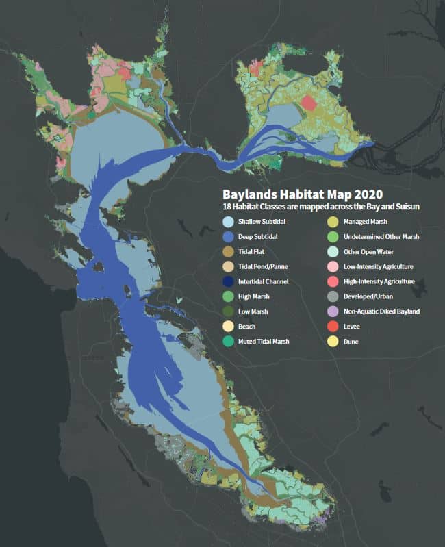
In April 2025, the San Francisco Estuary Institute (SFEI) released the long-awaited report on the extent and health of tidal wetlands in San Francisco Bay – “Tracking Tidal Wetland Extent in San Francisco Bay: A 2020 mapping update.” The report provides a wealth of information in a format that is very accessible. The tidal wetlands ecosystem is defined and helpful figures provide an understanding that tidal wetlands are a complex of different habitats, occurring at different elevations. The importance tidal wetlands as a habitat is described and some of the many societal and ecological benefits we receive from healthy tidal wetlands identified.
Most important, this report provides an update on the state of tidal wetlands habitats as of 2020 (the last mapping was in 2009) and includes maps depicting extent of tidal wetlands within the San Francisco Estuary (53,700 acres as of 2020), the location of tidal wetlands restoration projects and the threats posed by climate change.
This is a definite read for anyone interested in learning more about what many scientists believe is the most important habitat type due to all the benefits provided (carbon sequestration, flood water and wave attenuation, water quality improvements, support of fisheries, support of recreation and tourism, etc.).
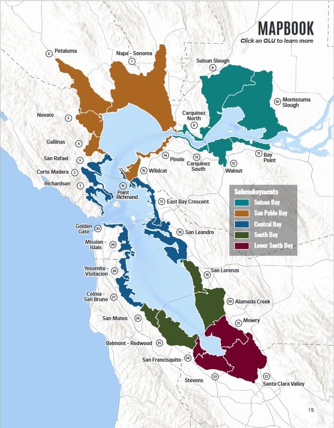
The second publication released by SFEI in March 2025, “San Francisco Baylands Resilience Metrics Mapbook – A Summary of Sea Level Rise Resilience Challenges and Opportunities.”
This report describes the challenges facing our shoreline communities and habitats of the Bay as sea levels continue to rise. It introduces the concept of “nature-based solutions” (NBS) as viable solutions for protection of our communities and the ecological health of the Bay. Building on the foundation provided by the 2019 “San Francisco Bay Shoreline Adaptation Atlas”, the report takes a deeper dive into each of the 30 Operational Landscape Units (OLUs) to describe potential resilience opportunities utilizing NBS that exist within each OLU in more detail.
The Mapbook includes an extensive glossary for all of the terminology pertaining to tidal wetlands and is meant to “…be a companion to the Resilience Metrics Web Map, which provides data that can help planners, engineers, and others build ecological resilience into sea level rise adaptation efforts.”